

Island forecast
Kahului, Maui Weather
Clear daily guidance, radar access and the latest regional weather reporting in one place.
Multi-day outlook
Forecast timeline
Scroll for the full forecast
Tonight
Sunday
Sunday Night
Monday
Monday Night
Tuesday
Tuesday Night
Wednesday
Wednesday Night
Thursday
Thursday Night
Friday
Friday Night
Saturday
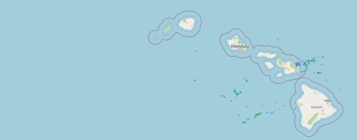 Weather Radar
Regional forecast
Regional Maui Weather Forecast July 25, 2026

West Side
Today: Breezy. Mostly sunny with isolated showers. Highs 75 to 88. Northeast winds 10 to 25 mph. Chance of rain 20 percent.
Tonight: Partly cloudy. Breezy. Scattered showers in the evening, then isolated showers after midnight. Lows 68 to 78. Northeast winds 15 to 25 mph. Chance of rain 40 percent.
Sunday: Breezy. Mostly sunny with isolated showers. Highs 75 to 88. Northeast winds 10 to 25 mph. Chance of rain 20 percent.
South Side
Today: Mostly sunny. Breezy. Highs 76 to 89. Northeast winds up to 20 mph increasing to 10 to 20 mph in the afternoon.
Tonight: Breezy. Partly cloudy with isolated showers. Lows 70 to 77. Northeast winds 10 to 20 mph. Chance of rain 20 percent.
Sunday: Mostly sunny. Breezy. Highs 76 to 89. Northeast winds 10 to 20 mph.
North Shore
Today: Breezy. Partly sunny with scattered showers. Highs 79 to 84 near the shore to around 65 near 5000 feet. East winds up to 20 mph. Chance of rain 50 percent.
Tonight: Breezy. Mostly cloudy with numerous showers. Lows 69 to 74 near the shore to around 57 near 5000 feet. Southeast winds up to 20 mph. Chance of rain 70 percent.
Sunday: Breezy. Partly sunny with scattered showers. Highs 79 to 84 near the shore to around 65 near 5000 feet. East winds up to 20 mph. Chance of rain 50 percent.
Central Maui
Today: Breezy. Mostly sunny with isolated showers. Highs 80 to 88. East winds 10 to 20 mph. Chance of rain 20 percent.
Tonight: Breezy. Partly cloudy with scattered showers. Lows 70 to 75. East winds 10 to 20 mph. Chance of rain 40 percent.
Sunday: Breezy. Mostly sunny with isolated showers. Highs 80 to 88. Northeast winds 10 to 20 mph. Chance of rain 20 percent.
Upcountry
Today: Mostly sunny. Breezy. Scattered showers in the morning, then isolated showers in the afternoon. Highs around 60 at the visitor center to around 62 at the summit. East winds up to 20 mph. Chance of rain 50 percent.
Tonight: Breezy. Partly cloudy with scattered showers. Lows around 49 at the visitor center to around 46 at the summit. East winds up to 20 mph. Chance of rain 50 percent.
Sunday: Mostly sunny with scattered showers. Highs 54 to 68. East winds up to 15 mph increasing to 10 to 15 mph in the afternoon. Chance of rain 50 percent.
East Maui
Today: Breezy. Partly sunny with scattered showers. Highs 79 to 84 near the shore to around 65 near 5000 feet. East winds up to 20 mph. Chance of rain 50 percent.
Tonight: Breezy. Mostly cloudy with numerous showers. Lows 69 to 74 near the shore to around 57 near 5000 feet. Southeast winds up to 20 mph. Chance of rain 70 percent.
Sunday: Breezy. Partly sunny with scattered showers. Highs 79 to 84 near the shore to around 65 near 5000 feet. East winds up to 20 mph. Chance of rain 50 percent.
Lanai City
Today: Mostly sunny. Breezy. Highs 71 to 82. Northeast winds 10 to 25 mph.
Tonight: Partly cloudy. Breezy. Isolated showers in the evening. Lows 64 to 70. Northeast winds 10 to 20 mph. Chance of rain 20 percent.
Sunday: Mostly sunny. Breezy. Highs 71 to 82. Northeast winds 15 to 25 mph.
Kaunakakai
Today: Mostly sunny. Breezy. Highs 68 to 88. Northeast winds 10 to 25 mph.
Tonight: Breezy. Partly cloudy with isolated showers. Lows 60 to 76. Northeast winds 15 to 20 mph. Chance of rain 20 percent.
Sunday: Mostly sunny. Breezy. Isolated showers in the morning. Highs 68 to 88. Northeast winds 15 to 20 mph. Chance of rain 20 percent.
Detailed Forecast
Synopsis
A strong high pressure system far north of the Hawaiian Islands will continue to produce moderate to breezy trade winds through Monday with periods of showers favoring windward mountain areas in the overnight to early morning hours. Hurricane Fausto remains on track to pass near the Hawaiian Islands early next week. The latest forecast for Fausto shows a weakening trend to tropical storm strength as it moves closer to the island chain. A drier and breezy trade wind weather pattern will return across the state from Thursday onward as Fausto drifts westward away from the Hawaiian Islands.
Discussion
A strong high pressure ridge remains locked in place north of the Hawaiian Islands, keeping easterly trade winds in the forecast through the end of next week. One exception to this trade wind weather pattern will develop early next week as Hurricane Fausto continues to track into the Hawaii region. Fausto remains on a high confidence east to west track towards the Hawaiian Islands based on the latest forecast from the National Hurricane Center.
Hurricane Fausto will likely weaken to tropical storm strength as the low center makes its closest point of approach near the Big Island on Tuesday and near Kauai by Wednesday. However, subtle shifts in the storms track or intensity may lead to significant forecast changes in island by island weather impacts. We strongly encourage the public to pay close attention to this passing storm system as weather impacts over the Hawaiian Islands early next week will likely evolve over time.
Potential Fausto Impacts Include…High surf above advisory thresholds along east facing shores from late Sunday through Tuesday, strong winds to around 40 MPH with stronger gusts may develop near and north of the low center and heavy rain threats are possible as Fausto moves from east to west across the region from Tuesday through Wednesday.
No time like the present to review your family hurricane preparedness plans, and ensure every household has at least a 14 day supply of food and water available if needed during this years active hurricane season.
A drier and more stable breezy trade wind pattern will fill in across the state from Thursday onward as Fausto continues to journey westward away from the Hawaiian Islands.
Aviation
Breezy trades through the forecast period. Low cigs and SHRA expected over windward and mauka locations. MVFR conds possible in heavier SHRA, otherwise VFR prevails.
AIRMET Tango remains in effect for lee turb.
Marine
Fresh to locally strong trade winds will persist through Sunday as robust high pressure centered far north of Kauai drifts westward, and the Small Craft Advisory (SCA) for the typically windy waters around Big Island and Maui County has been extended through Sunday afternoon. Trades should decline slightly and shift out of the north northeast late Sunday into Monday as Fausto approaches the area. The National Hurricane Center continues to call for Fausto to weaken to a tropical storm well before it passes near or just north of the islands Tuesday through Wednesday, but uncertainty in the eventual track of the tropical cyclone means that the wind forecast remains unclear.
The current south-southwest swell is on a gradual decline, but an overlapping pulse of south-southwest swell is expected today. Swell energy has been slowly lowering on the nearshore and offshore buoys overnight, though there has been building 17 second energy at the offshore NOAA buoy 51002 during the last couple of hours. As a result, south shore surf may briefly drop below the High Surf Advisory (HSA) threshold early this morning followed by a rise around midday. The HSA for south shores has been extended through tonight and may need to be pushed into Sunday if the swell remains elevated. The swell will then slowly decline Monday and Tuesday, with a smaller south-southwest swell possible during the middle of the week.
Rough east shore surf will remain a notch above seasonal average through tonight as a result of fresh to strong trade winds. The trade wind swell will drop slightly as long period swell from Hurricane Fausto begins to arrive tonight and Sunday. The Fausto swell will likely produce advisory-level surf along east facing shores Sunday night or Monday, and High Surf Warning conditions are possible during the peak on Tuesday or Wednesday, depending on the eventual track of the tropical cyclone.
Surf along north-facing shores will remain at flat to tiny levels through the weekend. Some increase is expected as Fausto or its remnants pass over the region Tuesday and Wednesday.
HFO Watches/Warnings/Advisories
High Surf Advisory until 6 AM HST Sunday for south facing shores.
Small Craft Advisory until 6 PM HST Sunday for Maalaea Bay, Pailolo Channel, Alenuihaha Channel, Big Island Leeward Waters, Big Island Southeast Waters.
Check out their Maui Helicopter Tours today!
Data Courtesy of NOAA.gov


